Loading...

Aim

This project aims to create an Australia-wide database of wildlife entanglements that can be used to identify risk hotspots, key risk factors and the range (and prevalence) of species impacted. The collation and end use of this data will benefit greatly from widespread community involvement.

Description

Australia's native wildlife face a range of significant risks e.g. habitat destruction, road trauma, attacks from domestic/feral animals and disease. Entanglement in barbed wire, inappropriate fruit netting, discarded fishing line/tackle/netting and general rubbish (e.g. plastic rings on milk bottles) also represents a serious risk to wildlife, causing horrendous injuries (frequently causing death). Flying foxes, seabirds, water fowl, gliders, owls, marine mammals, turtles, macropods and reptiles are some of the species that unfortunately become entangled.

Reporting by the public to wildlife rescue groups of entanglement sightings will always be important – to minimise suffering and to maximise the chance of a successful rescue. Animals that have been successfully rescued and rehabilitated can then be returned to the wild. This reporting is also important to help build a solid body of data to help wildlife/conservation groups in their efforts to increase awareness of these risks to wildlife, and when engaging with government and corporate stakeholders to advocate for risk minimisation initiatives.

This project was inspired by the Wildlife Friendly Fencing initiative and has been expanded to include entanglements relating to discarded fishing gear, which still continues to be a significant risk to a range of animals, especially seabirds, water fowl and turtles. It is hoped that this app will be useful for (and support the efforts of) volunteer wildlife rescue groups around Australia who are faced with these challenging rescues on a daily basis, and help increase the use of wildlife-friendly fencing / fruit netting and the responsible disposal of fishing tackle/line and nets.

Sincere appreciation to Tolga Bat Hospital, Wildcare Australia Inc., Wild Bird Rescues Gold Coast, Bats Qld., Pelican and Seabird Rescue Inc., Bat Conservation & Rescue Queensland Inc. Reptile Rehabilitation Queensland Inc. and H. & D. Cuschieri for their advice and support.

A final thanks to all wildlife rescuers, carers, veterinary staff and members of the wider community around Australia for their dedication to helping our native wildlife, from reporting entanglements through to rescue, treatment, rehabilitation and release.

Atlas of Living Australia logoThis project is contributing data to the Atlas of Living Australia.

Get Involved!

Members of wildlife rescue groups and the wider community are encouraged to record any sightings of native animals that have been entangled by adding the relevant information on the app.

Equipment

Camera-equipped mobile device

Tasks

Recording sightings of native wildlife entangled in barbed wire, fruit netting, fishing line/tackle/netting or other forms of entanglement e.g. rubbish on the app, including a photo with other relevant information. If an entangled animal is alive or if unsure, please first call your nearest wildlife rescue group before recording its details and location in the app. If the animal has been deceased for some time, please record this in the app along with a photo for verification purposes and to minimise possible duplication of a recording of a sighting. Please note: to minimise undue stress on an injured and already stressed animal, please ensure that the photograph is taken from an appropriate distance.

Free of Cost Difficulty: Easy

Contact name

Leonard Fitzpatrick

Contact Email

entangledwildlifeaustralia@gmail.com

Lat: Lng:
Leaflet | Tiles from Esri — Sources: Esri, HERE, Garmin, Intermap, INCREMENT P, GEBCO, USGS, FAO, NPS, NRCAN, GeoBase, IGN, Kadaster NL, Ordnance Survey, Esri Japan, METI, Esri China (Hong Kong), © OpenStreetMap contributors, GIS User Community

Project originally registered in

Atlas of Living Australia

You can participate in this project in

Australia

Type of project

Citizen Science Projects

Image credits

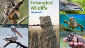
Logo: Adobe Stock: Flying fox (Craig); Glider (Krumanop), Blue Tongued skink (NatalieJean), Pelican (Vaclav Mach); Getty Images: Green turtle (Colin_Davis); Unsplash: Barbed wire (e-s) Feature image: Photo credit: Megan Clark (Unsplash)

News & Events

Tips on entering data into the Wildlife Entanglement Reporting Form

In the Resources section, you will find a simple guide to assist you in entering data into the form.

Mission Beach wildlife friendly fencing trial

News item from The Queenslander regarding encouraging results from a WFF trial in Mission Beach in north Queensland.

View More

Project stories

Fruit netting entanglements - NSW

Information from the NSW Department of Planning and Environment on the risks to wildlife from the use of inappropriate fruit netting and what to look for as a safer netting option.

View More

Wildlife friendly fencing - video from Local Land Services NSW

Local Land Services NSW have produced this video which provides a very good overview of the issue of wildlife entanglement due to the choice of fencing, and some easy adaptations to reduce the risk posed to wildlife.

View More
Found Resources

No Resources

Select a document to preview it here.

Entangled Wildlife Australia

Status: Active, In progress
Survey Ongoing
Start Date:
This project aims to create an Australia-wide database of wildlife entanglements that can be used to identify risk hotspots, key risk factors and the range (and prevalence) of species impacted. The collation and end use of this data will benefit greatly from widespread community involvement.
Download form template
Spatial accuracy confidence - Moderate
Species identification confidence - Moderate
Temporal accuracy confidence - High
Non-taxonomic data accuracy - Moderate
Number of data recording events in the dataset (count of activity records)
6,126
Number of species records in the dataset (count of species records)
5,048
Last Updated:
16 July, 2020
Public access to data
True
Survey attribution/citation:
Entangled Wildlife Australia. (2025) Entangled Wildlife Australia dataset download. Retrieved from https://biocollect.ala.org.au/bioActivity/projectRecords/23409a0b-6873-40a1-b291-f7eff3cbe837. 22/04/2025, 01:03.
Survey method type:
Opportunistic/ad-hoc observation recording
Survey/sampling method used:
Opportunistic/ad-hoc observation recording
Legal Custodian of the Dataset:
Entangled Wildlife Australia
Data quality assurance method
Data owner curated
Data quality assurance description
Data provided wildlife rescuers / rescue groups will be expected to have a higher degree of accuracy in terms of species identification.
Is the data management policy documented?
No

 Loading...
Searching...

Applied Filters:

Found record(s)

Indicates that only project members can access the record Indicates species absence record
Preparing download, please wait...

No data has been recorded for this project yet No results

  • Submitted On:
  • Recorded By:
  • Survey Name:
  • Project Name:

  • Submitted On:
  • Recorded By:
  • Survey Name:
  • Project Name:

No data has been recorded for this project yet No results

Bulk actions
  
  • Recorded on:
  • Submitted on:
  • Recorded by:
  • Coordinate:
  • Survey name:
  • Project name:
  • Submitted on:
  • Recorded by:
  • Survey name:
  • Project name:
Displaying the first 10,000 records returned. Use filter to reduce the number of returned results and to view other records.
 Loading...  Loading... No Results
 Loading...

None of the filters are set to display charts.

These graphs show data from the entries in the Filter results panel. Show charts per line.

Filters